The Great Canadian
CRYOSPHERE
Athabasca Glacier, Jasper National Park. Photo taken from Our Vanishing Glaciers by Bob Sandford.
Our Frozen Lands
What is the cryosphere?
Water exists in many forms. The cryosphere refers to the areas of Earth where water exists in any of its frozen states, including as seasonal snowpacks, ice sheets, glaciers, frozen ground, permafrost, and lake or river ice. The cryosphere is not static; it changes constantly. These changes can emerge season to season as winter comes and goes, but also on much larger timescales from decades to centuries to eons as the planet’s climatic conditions ebb and flow. When we talk about “the changing Canadian cryosphere,” what we are referring to are the changes in our country’s snow and ice patterns emerging as a result of climate change, such increasing rates of glacial recession, snowmelt, permafrost degradation and variability in hydrological conditions.
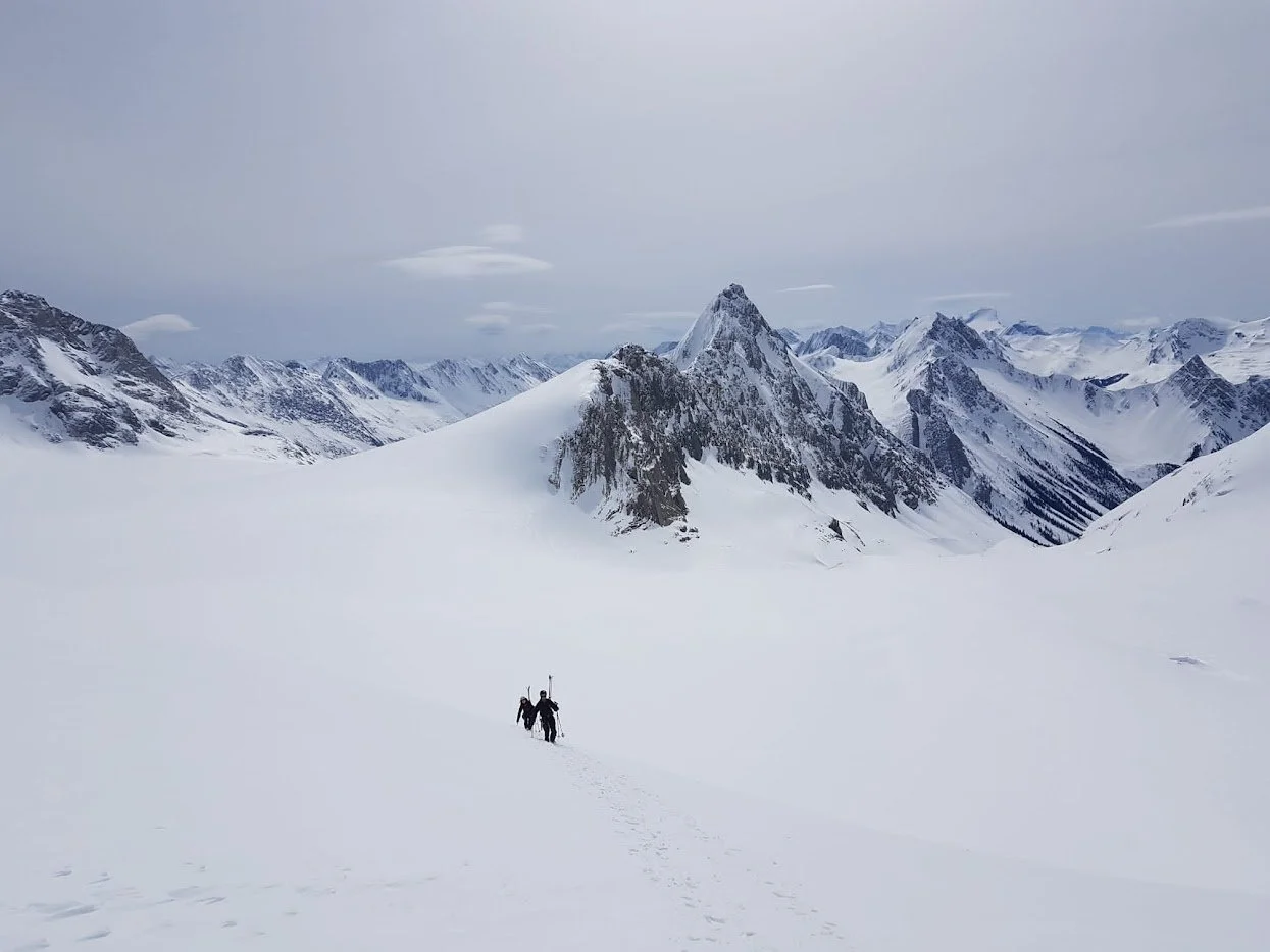
Photo by Kieran Lehan.
What are glaciers?
A glacier is a body of permanent ice that has been compressed by its own weight and has begun to move under the influence of gravity. These ice masses form as snow falls and accumulates long enough to be compressed into ice, a process that can take several of years. Many factors go into shaping glaciers, and depending on the specific altitude, climate and topography where the ice is forming, a number of different types of glacial ice may take shape. Globally, it is estimated that there are 160,000 glaciers covering around 650,000 square kilometers of terrain. Canada is home to around 20% of the world’s total glacial volume, but our glaciers in southern Canada are in rapid decline.
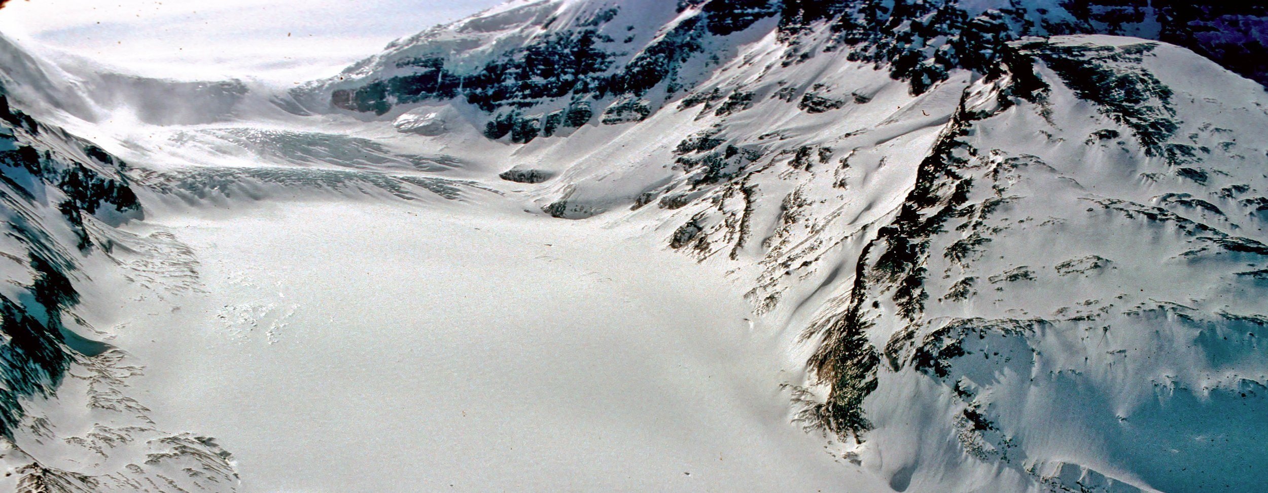
Peyto Glacier, 2023. Footage by Maddie Harasyn at the Centre for Hydrology, University of Saskatchewan.
What is permafrost?
Permafrost is frozen ground (either soil or rock) that maintains a temperature no higher than 0°C for at least two consecutive years. Permafrost dominates Canada’s arctic and sub-arctic landscapes, though isolated sections of permafrost can be found at high elevations in the more southern western mountain ranges like the Canadian Rockies. Permafrost distribution can be described in four ways: continuous, discontinuous, isolated, and sporadic. In the high arctic, permafrost terrain can be as deep as 700 metres, while in subarctic regions (such as near Yellowknife), it may only be a few metres thick. Depending on the location, the properties of permafrost can vary significantly as can the proximity of human activity, making the implications of permafrost thaw vary across the country.

The modelled distribution of permafrost across Canada. Permafrost refers to ground that is frozen for at least two years; dark purple indicates where the ground is likely always frozen, whereas areas in yellow indicate where the ground is remain frozen under certain conditions. ‘K1’ refers to the major mountain ranges in Canada. Source: The Canadian Mountain Assessment, McDowell et al. (2023).
Global Land Ice Measurements from Space: Glacier Viewer

Where do glaciers exist? The Global Land Ice Measurements from Space (GLIMS) project at the National Snow and Ice Data Center has implemented a database of glacier outlines from around the world.
The GLIMS Glacier Viewer allows users to view and search through different map layers, including glacier outlines, Regional Coordinator institution locations, the World Glacier Inventory, extinct glaciers, and more. GLIMS data can be downloaded into a number of GIS-compatible formats.
Different forms of glaciation
Ice sheets
A mass of glacial land ice extending more than 50,000 square kilometers. There are currently only two icesheets in the world: one in Greenland and one in Antarctica.

Mountain glacier
A body of ice that flows out of an icefield spanning several peaks.

Hanging glacier
As valley glaciers recede, their remnants can leave behind small ice masses clinging to steep slopes. These are called hanging glaciers.
Ice fields
An area spanning less than 50,000 square kilometres of permanent snow and ice. The Icefield Ranges of the Saint Elias Mountains located in Kluane National Park Reserve in the Yukon is the largest icefield in the world.

Valley glacier
Valley glaciers descend from icefields in mountain regions, forming long tongues of ice that flow downvalley.

Cirque glacier
Cirques are bowls carved into the sides of mountains by glaciers, and the glaciers that sit within them are called cirque glaciers. Below is a cirque featuring only glacial remnants.


Ice caps
Smaller than an ice field, icecaps are a glacial mass forming on an extensive area of relatively level land and flowing outwards from its centre. A mountain icecap is a flat or gently sloping alpine upland buried in ice.
Tidewater glacier
These a valley glaciers that terminate in the ocean. Rather than melting in the same fashion as land-glaciers, tide-glaciers typically calve into icebergs.

Rock glacier
Although rock glaciers typically contain a mix of ice and frozen sediments, unlike conventional glaciers, there is often no ice visible on its surface. Rock glaciers are a combination of rock, ice, snow and other frozen debris that mimic the movement of glaciers downslope.

Image credits from left to right: Icesheets from Our Vanishing Glaciers by Bob Sandford; Ice fields from the Centre for Hydrology, University of Saskatchewan; Mountain glacier photo from the Coastal Hydrology Research Lab courtesy of Alex Celbulski; Valley glacier from Our Vanishing Glaciers by Bob Sandford; Tidewater from Squarespace free images; Hanging glacier from Squarespace free images; Cirque glacier from the US National Park Service; Rock glacier from the US National Park Service.
Want to know more about how changes in glaciers, snow and ice affect Canadians?
Glossary
Ablation: Snow or ice removal through meltwater runoff, sublimation, wind scour, avalanching, or glacial calving.
Ablation zone: The area of a glacier where annual ablation exceeds annual accumulation, giving net loss of snow and ice.
Accretion: Increase in ice mass by freezing of basal water or surface water.
Accumulation: Snow or ice added to an ice mass via snowfall, frost deposition, rainfall that freezes on or in the ice mass, refrozen meltwater, wind-blown snow deposition, or avalanching.
Accumulation area ratio: The fractional area of a glacier represented by the accumulation zone at the end of the summer melt season.
Accumulation zone: The area of a glacier where annual accumulation exceeds annual ablation, giving net accumulation.
Active layer: The layer of seasonally frozen ground in contact with the atmosphere, usually with reference to permafrost terrain. Active layer depths vary from centimeters to several meters.
Alpine: The life zone in mountainous regions that extends above treeline. In the Canadian Rockies treeline historically ranged depending upon slope and exposure from about 2100 to 2250 metres or roughly 6800 – 7200 feet above sea level. But with warming conditions, treeline is slowly advancing both northward in Canada and upward in altitude. Life does, however, extend above the tree, usually in the form of high meadows composed of inter-connected low-lying rafts of plant life. The alpine life zone in the Canadian Rockies is also referred to as alpine tundra, for conditions in this life in this zone, in many ways, represent an southward extension due to altitude of the polar climate conditions that have create the tundra of the arctic.
Alpine valley glacier: A small mountain glacier fed by accumulation of snow in the same trough in which it flows.
Anthropocene: The geological epoch many scientists believe we have entered as a consequence of the fact that human activities now rival the processes of nature itself. Unlike earlier epochs in the Earth’s history which were brought about by natural forces including meteorite strikes and other geological events, this epoch is marked by humankind’s overall impact on the Earth system. Climate disruption is only one of the Earth system boundaries that mark the safe zone we must stay within if we want a prosperous future. By virtue of our numbers and our activities we have altered global carbon, nitrogen and phosphorous cycles. We are causing changes in the chemistry, salinity and temperature of our oceans and the composition of our atmosphere. Changes in the composition of the atmosphere in tandem with land use changes and our growing water demands have also altered the global water cycle. The cumulative measure of the extent to which we have crossed these boundaries is the rate of biodiversity loss.
Bergeron process: Process by which ice crystals grow at the expense of cloud droplets in mixed clouds, through selective vapour deposition onto ice crystals. This process is driven by the lower saturation vapour pressure over ice crystals, relative to water droplets.
Bergshrund: A large semi-permanent crevasse at the head of a glacier which separates the moving ice from stagnant ice or from the rock surface adjacent.
Carboniferous: A period of the Palaeozoic Era in the Earth’s history. It occurred between the end of the Devonian Period approximately 360 million years ago and the beginning of the Permian which began approximately 300 million years ago. During this period coal beds were laid down as central features of the stratigraphy of many parts of the Northern Hemisphere. The Carboniferous period is often broken down into two geological periods in North America, the earlier Mississippian and the later Pennsylvanian.
Cenozoic: The most recent geological era in the Earth’s history, extending from roughly 75 million years ago to the present (if recognized as such the Anthropocene will be defined as an epoch, which is of shorter duration than a larger era in which an epoch is but a part). This geological era includes the Tertiary and Quaternary periods. Much of the glaciation that has shaped the Canadian Rockies as we know them today has occurred during this era.
Clathrate hydrate: Gases (such as methane) trapped in an ice-crystal “shell” or “cage,” found frozen in permafrost and in shallow seafloor sediments in, for example, cold continental shelf environments.
Clausius-Clapyron relation: The thermodynamic relationship between pressure and temperature, which underlies both the pressure melting point depression in ice and the increase in saturation vapour pressure with temperature in the atmosphere.
Continental divide: A divide is a height of land separating two different watersheds. A continental divide separates watersheds that flow into different oceans. In the case of the Canadian Rockies, the continental divide, or Great Divide as it is often called, separates waters flowing into the Pacific Ocean into those that flow to the Atlantic. At the Columbia Icefield, there is a rare triple continental divide, which is the high point on Mount Snow Dome that separates waters flowing into the Atlantic, Pacific and Arctic Oceans.
Cretacious: A geological period in the history of the Earth that extended from roughly 145 to 66 million years ago, which is marked by the wholesale disappearance of many of the Earth’s earlier life forms, including most dinosaurs.
Crevasse: A crack or fissure in glacial ice. A crevasse is a break in ice, whereas a crevice is a narrow opening resulting from a split or crack in rock.
Cryosphere: Segments of the Earth featuring water in any of its frozen forms, including glaciers, snow, ice, and permafrost.
Debuttressing: The exposure of glacially steepened rockwalls due to the thinning and recession of glacier ice.
Equilibrium line altitude: The elevation at which seasonal snow accumulation balances ablation on a glacier.
Fast ice: Sea ice that is frozen to the shore. Also called landfast ice.
Firn: Multiyear snow that is in transition from meteoric snowfall to glacier ice. Firn densities typically range from 550 to 830 kilograms per cubic meter.
Firn line: The often quite obvious boundary on the upper reaches of a glacier above which winter snow does not melt. The firn line distinguishes where a glacier ends and where the icefield that forms it begins.
Floating ice: Ice that is floating in water. Lake, river, and sea ice form from in situ freezing of water. Once initiated, meteoric precipitation (snow or frozen rain-water) adds to the ice mass. In contrast, floating glacier ice is transported to the water body from a terrestrial ice mass. Icebergs are fragments of glacier ice that have broken off and are now floating.
Frazil ice: The early stages of small ice crystal growth in rivers, lakes, and oceans, when waters are supercooled and turbulent.
Frost: Deposition of ice on a surface, forming directly from water vapour.
General circulation model (GCM): Three-dimensional model of atmosphere or ocean dynamics. Conveniently, GCM also stands for global climate model, and this acronym is now used interchangeably.
Geology: The science that deals with the earth's physical structure and substance, its history, and the processes that act on it.
Glacial erratic: Large boulders carried by advancing glacial ice that are deposited on the landscape as the glacier recedes. Glacial erratics are known to have travelled hundreds of kilometers from the landscapes in which they were entrained by glacial ice.
Glacial flour: Fine-grained, silt-sized particles of rock, generated by mechanical grinding of bedrock by glacial erosion. The suspension of glacial flour in many of the lakes in the area of the Columbia Icefield area is of just the right concentration to make the water seem to glow turquoise. The dazzling blue of Peyto Lake and Lake Louise as seen from above is caused by suspended glacial flour. Also known as rock flour.
Glaciated: A region or landscape influenced by past glacial presence.
Glacier: A body of permanent snow that has been compressed by its own weight into ice that have begun to move under the influence of gravity.
Glacier ice: Polycrystalline ice formed from snow metamorphism, with a density of 830 to 920 kilograms per cubic meter.
Glacierized: A region or river basin where glaciers are currently present.
Glacier mass balance: The overall gain or loss of mass for a glacier or ice sheet over a specified time interval, typically a year. This can be expressed as a rate of change of mass as expressed in kilograms per year; as ice volume as expressed by cubic meters per year; or water equivalent volume as expressed in cubic meters of water equivalent per year.
Graupel: Granular snow pellets which are sometimes called soft hail.
Great Glaciation: A major glacial period that began in North America some 240,000 years ago, and appears to have lasted approximately 100,000 years.
Grounded ice: A glacier or ice sheet that is resting on bedrock or sediments. It can be grounded either above or below sea level.
Ground ice: Ice in permafrost of seasonally frozen ground. Also known as soil ice.
Hoar: A sparkling, crystalline form of frost on, above or below the snow surface. Depth hoar is recrystallized snow found in the bottom layers of the snowpack. It is this recrystallization at the base of the snowpack that can make steep snow slopes unstable triggering avalanches. Avalanches are very common in the Columbia Icefield area well into the spring.
Hoodoo: Towers of relatively soft glacial debris called till capped by a boulder or glacial erratic composed of harder rock buried in that till. Hoodoos are usually relatively impermanent features surviving only as long as the cap rock can protect the tower beneath it from erosion.
Hypothermia: The cooling of the core of the body to sub-normal temperatures; a condition that can bring on death.
Iceberg: A fragment of a glacier or ice shelf that has broken off from the main ice mass and is now floating in a lake or sea.
Icecap: A glacial mass forming on an extensive area of relatively level land and flowing outwards from its centre. A mountain icecap is a flat or gently sloping alpine upland buried in ice.
Ice Explorer: A custom-built 56-passenger vehicle developed specifically for travel on the Athabasca Glacier at the Columbia, but that is now being used in other glacial environments. The original name of the Ice Explorer was “Snocoach” which is not a misspelling but a contraction of the words “snow” and “coach” used to market the Athabasca Glacier experience.
Icefield: An area less than 50,000 square kilometres of permanent snow undergoing the processes of compressing itself under its weight into ice, which flows downhill in the form of glaciers.
Ice shelf: Glacier ice that has flowed into an ocean or lake and is floating, no longer supported by the bed.
Icesheet: A mass of glacial land ice extending more than 50,000 square kilometers. There are currently only two icesheets in the world: one in Greenland and one in Antartica.
Iceworm: A small annelid worm of the genus Mesenchytraeus that have been found to spend their life cycles within or on glacial ice. First discovered in Alaska in 1887, they were made famous by a poem written by Robert Service entitled The Ballad of the Ice-Worm Cocktail. Research indicates that these worms are among the most remarkably cold-hearty species in the world. But they can stand only cold, not heat. It appears that when ice worms are exposed to temperatures as high as 5 °C (41 °F), their membrane structures disassociate causing the worm to liquefy or “melt”. Though not common in the Rockies iceworms are known to exist abundantly in some areas of the North Cascade Range in British Columbia and Washington.
Katabatic wind: Downslope wind resulting from gravitational drainage of cold air masses. These are common on valley glaciers and the flanks of ice caps and ice sheets.
Lake ice: Floating ice on a lake, initially formed by freezing of the lake water.
Last Glacial Maximum (LGM): Period of maximum extent of the last Pleistocene glacial ice sheets, ca. 21,000 years ago.
Little Ice Age: A period of cooling that extended from about 1300 to about 1850 during which glaciers in the Northern Hemisphere including those in the Canadian Rockies appear to have advanced significantly.
Milankovitch Cycles: Variations in the Earth-Sun orbit on time scales of tens to hundreds of thousands of years, which lead to changing seasonality and latitudinal distribution of insolation. These orbital variations drive the glacial-interglacial cycles of the Quaternary period.
Millwell: A vertical hole through which surface water is carried down into a glacier. Some millwells are deep enough to carry meltwater right to the base of the ice. A millwell is the same as a moulin or a glacier mill.
Mixed clouds: Clouds from about 0˚C to about -40˚C, with a mixture of ice crystals, supercooled water droplets, and water vapour.
Moraine: A deposit of rock debris carried and shaped by glacial flow and erosion. Several types of moraines are found on and around the Athabasca Glacier and in the Columbia Icefield region. These include lateral, terminal, medial and ablation moraines, each of which is formed by the dynamics of different kinds of glacial action.
Moulin: See millwell.
Nêvé: The accumulation area of an icefield, often associated with thick layers of firn.
Ogives: A regular pattern of undulating bands of dark and light ice on the surface of a steeply descending glacier. These often evenly spaced bands bend down-glacier because the glacier moves faster at its centre than it does on its edges. The dark bands are composed of ice that moved over the icefall down which the glacier is pouring during the summer season. The light bands are composed of ice that moved over the icefall during the winter.
Ordovician: A geological period in the Earth’s history extending from about 485 million years ago to about 445 million years ago. During the Ordovician, the continents of the Southern Hemisphere coalesced into a single continent called Gondwana which slowly began to drift toward the South Pole. During the same period, the continents Laurentia (present-day North America), Siberia, and Baltica (present-day northern Europe) were still independent continents. Fossil fish have been discovered from this period and, on land, the preserved remains of mosses.
Outlet valley glacier: a glacier, such as the Athabasca Glacier, that flows out of a major icefield accumulation zone and into a neighbouring valley.
Pack ice: Drifting ice that is consolidated.
Pancake ice: Discrete, rounded pieces of sea or lake ice up to a few meters in diameter.
Periglacial: Terrestrial environments influenced by glacial or permafrost activity.
Permafrost: Perennially frozen ground, technically defined as ground that is at or below 0˚C for at least two years.
Planetary boundaries: A conceptual framework featuring nine different aspects of Earth’s natural system over which humankind is exerting significant influence. Each category features a boundary for safe operating space, referring to the ecological limits within which our society can comfortably function. Crossing these boundaries means entering a zone of uncertainty within which we risk crossing thresholds that will trigger non-linear, sudden ecological change at great risk to humanity as we are currently organized. The nine boundaries are: climate change; biodiversity loss; ocean acidification; aerosol loading; biogeochemical flows; land-system change; novel entities; freshwater use; and stratosphere ozone depletion. As of 2023, it is estimated that we have passed the boundaries for six of the nine categories. Read more here: https://www.stockholmresilience.org/research/planetary-boundaries.html
Pink snow: Spring snow turned pink or red by the algae known as Chlamydomonas nivalis, also colloquially termed watermelon snow. Creatures that thrive at or below the freezing point of water are known as cryophiles. There are a lot more of these species than anyone suspected. A 1968 study reported the presence of 466 species of microorganisms found in snow, of which 77 were fungi and 35 were bacteria. The remainder are algae. The best known cryophiles found in this area of the Rocky Mountains are the red algae found in snow in concentrations large enough to turn the spring and summer snowpack pink. For many of these organisms, optimal growth can only occur at temperatures below 10˚C. In some strains of snow algae, particularly Chlamydomonas nivalis which is most common here, optimal grown of motile vegetative cells occurs at temperatures between 1˚C and 5˚C. The very upper limit of temperature at which growth can occur in many of these species is between 16˚C and 20˚C. Minimal temperature for growth is 0˚C or even lower. It is the survivability of these algae at extremely cold temperatures, however, that is truly spectacular. In laboratory tests, viable cells of snow algae have recovered from temperatures as low as -196˚C.
Pleistocene Ice Age: The last approximately 2.6 million years in Earth history, characterized by at least 40 advances and retreats of glacial ice over much of the world, in particular the Northern Hemisphere land mass. Also known as the Quaternary Age.
Proglacial: The environment adjacent to a glacier, also referred to as the glacier forefield. For most contemporary glaciers, the proglacial environment is the recently deglaciated region where vegetation has yet to take hold.
River ice: Floating ice on a river, initially formed by freezing of the river water.
Rock flour: Fine-grained, silt-sized particles of rock, generated by mechanical grinding of bedrock by glacial erosion. The suspension of rock flour in many of the lakes in the area of the Columbia Icefield area is of just the right concentration to make the water seem to glow turquoise. The dazzling blue of Peyto Lake and Lake Louise as seen from above is caused by suspended rock flour. Also known as glacial flour.
Sea ice: Floating ice formed by the freezing of sea water.
Serac: A standing tower of ice breaking off a glacier as it stretches downslope over an icefall.
Snow: Ice-crystal precipitation that accumulates on Earth’s surface.
Snowball Earth: Episodes of complete global glacier and sea-ice cover in the Earth’s distant past.
Solar wind: The great storm of light and radioactive particles through which the Earth spins as it passes through the sun’s glow.
Specific mass balance: The area-averaged mass balance rate on a glacier expressed as kilograms per square meter per year, but often expressed at the rate of water-equivalent thinning or thickening as measured by meters of water equivalent per year.
Subglacial: The environment beneath a glacier, at the ice bed interface.
Supraglacial: On the surface of a glacier.
Surface mass balance: The mass balance at the atmosphere-glacier interface, associated with net snow accumulation minus surface ablation. This is often referred to as the glacier’s mass balance, but strictly speaking mass balance also includes the gain and loss of ice in englacial, subglacial, and ice margin environments.
Thermokarst lakes: Features of Arctic landscapes, formed when permafrost thaws and creates surface depressions that fill with melted water.
Watermelon snow: See pink snow.
Watershed: The area drained by a river system, or a ridge dividing the areas drained by different river systems.

Shaffer Ridge, Yoho National Park. Photo by Iris Fairly-Beam.